
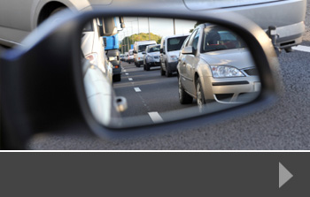
The busiest day on the roads this Christmas…
With millions of us travelling to see friends and family over the festive season, the UK’s road networks can be filled to capacity on one or two key dates over the holidays. The dates change each year, depending on when Christmas Day falls, so transport planners and road users alike need to plan well ahead.
Friday December 21st
According to a survey by the AA of around 20,000, most people are planning to travel on Friday December 21st. For many people, this will be the last day in the office; the kids have broken up from school, and everyone is hitting the roads to get to their families for a full weekend ahead of Christmas. So, what does that mean for the road network?
Congestion
Nearly 60% of those surveyed said they would be on the roads on the 21st, which means the network has to cope with far more traffic than usual – even for a Friday. Drivers should expect their journeys to take longer than usual and be prepared to sit in traffic jams. There are several areas on high-traffic motorways where roadworks are still in progress, with 50 mph restrictions and these are likely to be high points of congestion.
What to do
- Do you really have to travel on Friday? If you do, can you leave earlier to avoid the later traffic caused by people finishing work early or travelling straight from the school pick-up? Would it matter if you left early on Saturday morning instead of on Friday afternoon? For longer journeys, setting off early in the morning can take a lot of the hassle out of the journey, and still get you to your destination at a reasonable time.
- Check current traffic conditions before you leave. Google Maps has a function where you can say what time you’d like to arrive at your destination, and it tells you when you might leave in order to get there on time.
- Make sure that, as well as the Christmas presents, the food, the wrapping paper, the booze and the overnight bags, you pack anything you might need in the event of a breakdown. Join a breakdown service or, if you’re already a member, make sure you have your membership card with you.
- If there is something wrong with you vehicle on the motorway, try to take the next exit off the motorway, or go into a services area if that’s closer. If you can’t do that, pull over onto the hard shoulder, put your hazard lights on and get out of the vehicle – preferably by the doors closest to the embankment. Call your breakdown service – you can do this from your mobile phone or from one of the emergency phones on the side of the motorway.
About Road Data Services
Road Data Services is a traffic and pedestrian data specialist. We conduct a range of bespoke traffic surveys, journey time data collection, parking and pedestrian surveys, providing data to a range of decision makers including developers and local planners. Our data helps to inform decisions that involve changes to the existing road network, or the design, construction and use of new roads. For more information about how we can help with your next project, contact us today.


As a company that specialises in pedestrian surveys – looking for ways to make places safer for all the people who use them – we were interested to see a recent statement by the Department for Transport.
The statement said that the government is planning to review the current Highway Code, in order to update guidance on how to make sure pedestrians and cyclists are safer when using the road system. The review is part of the government’s drive to reduce the fatality rate amongst this group of road users.
In particular, the review will give new and clearer guidance on the issue of ‘close passing’, to help drivers be aware of how wide a berth they should ideally give to cyclists and pedestrians. Many accidents are caused when vehicles pass too closely, either making contact with the cyclist or pedestrian, or unnerving them so that they lose control and fall into the path of the vehicle. The review will also look at the issue of people opening vehicle doors into the road without checking whether there is a cyclist approaching.
Focus on pedestrian health and safety
The Cycling and Walking Minister, Jess e Norman said: “Britain has some of the safest roads in the world, but we need them to be safer still for all – and particularly for cyclists, pedestrians and other vulnerable road users. Cycling and walking are increasingly being understood as crucial parts of an integrated approach to issues of health, obesity, air quality and town and city planning. But this will only happen if people feel safe on the roads. These measures are part of a steady process of improvement and reform designed to achieve just that.”
The Department for Transport has also announced a new national guide for safe cycling, and said that Highways England has agreed a £3m contract with Sustrans to deliver improvements to the National Cycle Network.
The impact of pedestrian surveys
It’s easy for pedestrians to be ignored when it comes to network improvements, or indeed new developments. And yet, providing safe, accessible and attractive pedestrian areas, along with clear crossings, traffic calming and other infrastructure can completely transform not just the look and feel of the area, but the safety of all those using it.
At RDS, we work with a wide range of clients to encourage pedestrian and non-motorised access to towns, cities and new developments. To find out more, contact us today.
With the news that consultation is underway on making London’s Oxford Street pedestrianised, local authorities, planners and developers will be considering how to maximise pedestrian access to existing and new developments – and whether to commission a pedestrian survey to gather data on current use.
There are many reasons to increase pedestrianised areas – they provide a safer and more relaxed shopping, leisure and working environment; they improve the local eco-systems and they allow for additional use for the area, including markets, street entertainment, outdoor eating and more.
This is particularly true for office, retail and leisure areas, but developers are increasingly including pedestrian areas in residential planning too. Reducing traffic leads to a greater sense of community – it’s safer for children to play outside, for example, and pedestrian areas bordered by good landscaping provide areas for residents to socialise together.
Catering for pedestrians can be something as simple as wider footpaths, so that prams, buggies, wheelchairs and groups of walkers can all use it easily. It might extend into paved or pathed areas around the development, allowing for easy walking from one building to another, or for people to cut through a housing estate to reach the local amenities without needing to use the car.
Why pedestrian data matters
Well-planned pedestrian access relies on an understanding of how people use the environment in which they live and work. A pedestrian survey can give you that information for an existing area that may be part of redevelopment plans, or for a new development where priority is given to those who are walking or using bikes and public transport as an alternative to cars. These areas have to be safe, well-lit and planned so that they are intuitive to use.
It’s particularly important that pedestrian areas cater for those who have mobility problems, and that developers understand how people are accessing the site – in an urban setting, for example, many people might be coming from public transport stops, so areas serving this type of use need to be wider, lit at night and possible also offer shade and weather protection.
Where there are roads, thought needs to be given to safe pedestrian crossings, which need to be sensibly planned, and be adapted for those who need additional assistance crossing the road.
Pedestrian surveys from RDS
At Road Data Services, we carry out a range of manual and video surveys to see how pedestrians use an area currently, and to highlight where there are danger points or key areas to consider, such as school entrances or hospital facilities. These surveys can be stand-alone or paired with our traffic surveys so that you get all the data you need to make informed development or planning decisions. To find out more, contact us today.
It’s often been said that one of the biggest problems with transport planning in the UK is that various parts of the country are disconnected from one another. This means poor communications and a lack of consistency across the network.
The thing that could bring all these disparate elements together is a national transport plan. It’s something that’s been on the wish lists of regional planning groups for some time and a recent government white paper on house building pledged to align infrastructure spending with the Housing Infrastructure Fund.
The Housing Infrastructure Fund is worth over £2bn and targets those areas with the greatest housing need. The white paper suggests that, in order to encourage the delivery of new homes in these areas, infrastructure projects such as transport and utilities upgrades should be funded alongside house building.
What’s more, with other transport links underway, such as HS2, a greater emphasis on more usable public transport, and predictions about the escalation in the number of road users despite additional public transport alternatives, it is becoming crucial that the road network is upgraded and extended to reduce congestion, improve journey times and increase safety.
Why traffic surveys help
Whether existing road systems are changing or new roads being introduced, a range of reliable data is needed to help with design and planning decisions. A variety of traffic, journey and road-user surveys are needed in order to assess existing road use and provide the information from which planners can predict the impact of changes to the system.
This is particularly important in the case of housing developments, where often hundreds or even thousands of new homes are built in a single area, increasing the potential road traffic significantly. A professional traffic survey uses the latest equipment to survey and collect data in whatever format is best for the client. Traffic can be surveyed across a range of days, times and conditions, giving a full picture of road usage and having a significant influence on the decisions that are taken at the planning stage.
Traffic surveys and more from RDS
At Road Data Services, we provide a wide range of transport and road-user related surveys, including pedestrian surveys and parking data. To find out more about how we can help you with your next transport planning or development project, please call us today.
A recent report by the Parliamentary Advisory Council for Transport Safety (PACTS) shows that whilst the UK enjoys an excellent record for low vehicle occupant fatalities compared with other countries, pedestrian safety could certainly be improved.
The report, which puts the UK’s roads amongst the safest in the world, ranked alongside Sweden, Netherlands, Norway and Switzerland, suggests that the poor record for pedestrian safety could be related to the safety ratings of new cars. It says that new cars in the UK have, on average, lower safety ratings than those sold in the other top rated countries. This includes those cars which have low pedestrian safety ratings, placing the UK 19th out of the 28 European Union countries in terms of pedestrian protection.
Pedestrians and other vulnerable road users
The UK’s record is also poor for what PACT terms ‘vulnerable road users’. This includes motorcyclists and cyclists in addition to pedestrians, with deaths in all three groups higher than in many other European countries. The UK also had a higher proportion of fatalities on roads where the speed limit is higher than 60mph, and on motorways.
An executive director of PACT, David Davies, said: “Are there areas where comparatively speaking, Britain could do better and where investment and effort might be best concentrated? The Government needs to promote cars that are low on emissions and high on safety, including pedestrian protection. PACTS urges the public and private sectors to buy only the safest vehicles – those with a 5* safety rating.”
Safety first – pedestrian surveys from RDS
At Road Data Services, we offer a range of bespoke survey options which allow traffic planners, road safety specialists and developers to ensure greater pedestrian safety. From the siting of pedestrian crossings, to speed management measures, our data can show you where you may face critical safety issues. We work with groups concerned about particular pedestrian flash points, such as outside schools, shops and hospitals, as well as with developers planning new housing, retail and business sites.
To find out more about how our pedestrian surveys can help to positively influence your decision making, contact our office today.
It’s one of the most emotive road safety issues of our time: how to keep children and other road users safe at school drop-off and pick-up times, when traffic is busy, and drivers often distracted. The AA Populous Motoring Panel traffic survey for April 2016 found that 57% of those surveyed who had school-age children said that there is often traffic chaos near the school their children attended.
There are a number of ways that surveys could help to ease traffic problems at these vulnerable locations. Both traffic and parking surveys can be used to collect and analyse data on the quantity of traffic using the roads at key times – and compare them with the volume at off-peak periods. And because parking is often one of the reasons why traffic gets so quickly snarled up around these times, it makes sense to look at parking options, including providing dedicated parking, offering rolling drop-off times so that children aren’t all coming to school at the same time, and imposing parking restrictions around the immediate vicinity of the school, so that roads and junctions are kept clear.
These types of traffic volume study and parking analysis can be used to inform changes to the road system, and to demonstrate the impact of further developments in and around the school area, including increasing the pupil intake at the school, and building new housing developments nearby. Local planners may also choose to put in traffic calming measures such as priority lanes, speed bumps and lower speed limits, to encourage safer and slower driving. In addition, for those schools with a wider catchment area, traffic surveys can help to boost plans for additional bus services, helping to reduce the number of cars travelling to school at any one time. Match this with car-share schemes, encouragement to walk or cycle to school rather than travel by car, and even diverting non-school traffic from nearby roads at key times, and it’s easy to see how good quality data can help to influence positive road safety changes.
Bespoke traffic surveys from RDS
At Road Data Services, we specialise in collecting a wide range of traffic survey data, parking, pedestrian and journey time data, using a range of reliable methods. These result in good quality data that can be reported in the way that’s best for your project, helping you to make a strong case for a change in the existing road system, plans to develop or create new road systems, or just to show that the current system is actually the best one for the circumstances. To find out more about how we can help, just contact us today.
Portsmouth City Council has announced a £2m plan to improve pedestrian and bike safety on roads around the city, making them safer for pedestrians and cyclists to use. The plan, which follows consultation through statistical cycling and pedestrian surveys, is focused on specific junctions and sections of road that have proven dangerous in the past.
Pedestrian crossing signs and cyclist markings
Key to the improvements will be a ‘Safer Route to Schools’ scheme that encourages families to walk to school by upgrading safety measures, adding crossings and pedestrian signage and a dedicated cycle link for schools where appropriate. Target junctions will also be marked to give cyclists priority and to make vehicle users more aware of the cyclists using the route.
In addition, speed reduction schemes, signal upgrades at roundabouts and verge maintenance to increase parking provision are all part of the plan.
When do you need help with route choice?
The upgrades and new plans announced by Portsmouth City Council are the result of consultation and analysis of data. All councils want to improve safety on their roads – particularly for pedestrians and cyclists at a time when people are being encouraged to leave the car at home and find other ways of getting around.
To make sure you have all the information you need to alter existing routes, plan new roads for developments and keep all road users safe, it’s wise to invest in a range of detailed surveys that give you valuable data in a format you can use.
Pedestrian surveys from RDS
At Road Data Services, we specialise in designing, implementing and reporting surveys that focus on traffic, parking, journeys and pedestrians. These surveys are used by developers, planners, local authorities and a range of other interested parties to inform long-term decision making about traffic flow, road safety and highways policies.
To find out more about any of our services, or to talk to us about your next project, please contact us today.
When councils are considering significant road improvements or developments, they need to bear a number of considerations in mind. Naturally, smooth traffic flow and access to commercial and retail developments is important, but pedestrian and cycle safety is playing an increasingly important role in decision-making.
Accurate pedestrian surveys
Encouraging sustainable travel is important to councils all across the UK. Schemes to entice people to walk or cycle instead of drive are becoming more common, and if councils want these schemes to succeed, they need to ensure that they provide safe routes, appropriate crossings and designated areas so that these more vulnerable road users are safe.
One of the best ways to assess current usage is to conduct a pedestrian survey. This puts experienced people on the ground in the affected area, talking to pedestrians about how, why and when they use the current routes available and what their opinions are about potential new routes or additional safety measures.
Pedestrian and cycle safety in Bristol
A scheme to improve safety in Bristol is considering all road users. There are two areas – Junction 1 of the M32 and the A4174 at Hambrook. Two separate crossings will be substantially improved by South Gloucestershire Council, who will be spending £1.3million pounds at Hambrook alone. The work will be carried out on existing crossings with the aim of making crossing busy junctions much safer, thereby encouraging people to walk or cycle instead of drive.
This work is part of an £8m scheme in the area that will see work to improve road surfaces for drivers as well as creating safe walking and cycling routes. Funding for some of the work is coming from the Government’s Cycle Ambition Fund, which supports councils who want to add sustainable transport options in their areas.
Pedestrian surveys from RDS
At Road Data Services we can design, carry out and analyse pedestrian surveys across the UK. Our experience means you can leave us to get on with the job, representing your organisation in a friendly and professional manner and extracting the information you need in the best format for you. Our pedestrian surveys have helped councils, developers and other organisations to make the best choices for safer journeys. Contact us today to find out more.
With towns and cities across the UK competing for businesses to choose them as a location for office or manufacturing space, it’s vital that they look at the key areas of importance to those businesses. For many, it’s the ease of access to business parks or central areas, along with a supply of affordable housing, skilled people and good facilities. Towns and cities that struggle with traffic management could get left behind.
Why commission a traffic survey?
There are many reasons why developers, councillors and planners need to have accurate and up-to-date information on the traffic in their area. Planning a new business park on the outskirts of town may attract business, but councils also need to keep local people and existing businesses happy, so the ease of travel to and from a new development, alongside a clear understanding of parking issues is vital. This is knowledge that should be acquired in the early stages of development, rather than as an afterthought.
Parking is often a problem, both for cities that are attracting large businesses, and towns where parking options are often limited. Many towns address this problem by developing park and ride schemes, which require land at the edge of the business area, but reduce the amount of traffic travelling through the centre of town. A parking survey can help to ascertain the reasons people are parking in a certain area, how long they stay for and what other parking options they would be prepared to consider.
Pedestrians and cyclists are just as important when assessing business needs. Greater numbers of people are choosing to cycle to work, or use public transport and walk. This means that consideration must be given to safe places to cross the road, cycle lanes that separate cyclists from other traffic, and ways of ensuring public transport can run smoothly and on time. All these issues help people to get to work more easily, making them happier to work in a specific location and therefore easier for businesses to recruit.
Traffic surveys from Road Data Services
Our bespoke surveys are designed to help you gather the information you need for your project. Whether you are expanding an existing business area, planning a new development, or struggling to manage increased traffic numbers, you need precise data that gives you a clear picture of what’s happening right now.
We can design and carry out a wide range of surveys including pedestrian and parking surveys, and report back to you with easily-understandable data to help you take informed decisions. Contact us today to find out more.
Pedestrians are the most vulnerable groups on the road network, with around 1.2 million people being killed every year around the world. Pedestrian safety is a particular problem in developing countries where car ownership and consequently traffic is increasing faster than the safety laws can keep up, but even in the UK, pedestrians are still at risk. Could a pedestrian survey help to make things safer?
What pedestrians can tell us
Usually, a survey is commissioned for a particular purpose: when road use is changing, for example, or when there have been several serious accidents or even a fatality at a junction or crossing point. At this time, interviewers will talk to pedestrians about the way they use the area, and may also talk to drivers and cyclists to see what improvements can be made. These surveys gather information such as:
Impact of traffic speed
Line of sight
Road width and existing crossing points
Number of pedestrians using route
Key times of day for pedestrian footfall
Whether drivers can see pedestrians approaching or crossing
Using survey results in planning
The more information that planner and traffic highway officers have, the safer they can make the roads for the traffic and pedestrians that use them. That’s why a good survey will be based on in-depth conversations with interested parties, making sure that all the relevant questions are being asked. Pedestrian surveys are often carried out at the location, so it’s important that the survey is easy to understand and quick to complete, allowing people to get on with their journey.
The results can help planners to see if new road layouts would improve safety, or decide which sort of pedestrian crossing would work best in the circumstances. A bigger solution may be called for, such as a bridge over the top of the road or an underpass beneath it. Where new developments are concerned, particularly those that include housing, pedestrian safety and access should be a key feature of the traffic planning and management process.
Pedestrian surveys from Road Data Services
We are experienced pedestrian surveyors and can help you to design and carry out a survey that will give you all the information you need to make an informed decision. To start the process, or to find out more, contact us about pedestrian surveys today.